India Successfully Launches Satellite to Boost Indigenous GPS System: What Is NavIC and How Does It Benefit India?

India is steadily strengthening its position in space technology and becoming more self-reliant in critical areas of science and defence. One important achievement in this direction is the development of NavIC (Navigation with Indian Constellation), India’s indigenous satellite navigation system.
Developed by the Indian Space Research Organisation (ISRO), NavIC is designed to provide accurate positioning, navigation and timing services across India and surrounding regions. The system reduces India’s dependence on foreign navigation systems such as America’s GPS.
The launch of additional navigation satellites is an important step towards strengthening India’s independent navigation capabilities.
What Is NavIC?
NavIC stands for Navigation with Indian Constellation. It was earlier known as IRNSS (Indian Regional Navigation Satellite System).
It is India’s independent regional satellite navigation system, developed by ISRO to provide accurate location and timing information.
NavIC primarily covers:
– The entire Indian landmass.
– Areas extending approximately 1,500 km beyond India’s boundaries.
Unlike GPS, which is operated by the United States and offers global coverage, NavIC is specifically designed to serve India and its surrounding region.
The system was developed to ensure that India has reliable access to navigation services without depending entirely on other countries.
Why Has ISRO Launched the NVS-03 Satellite?
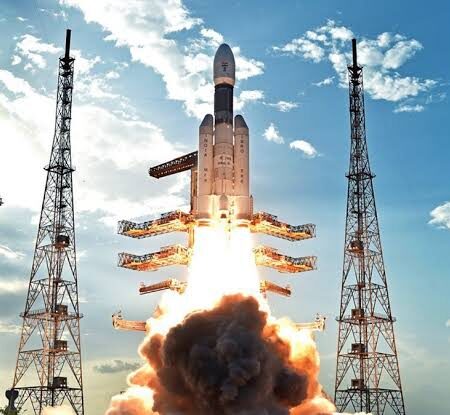
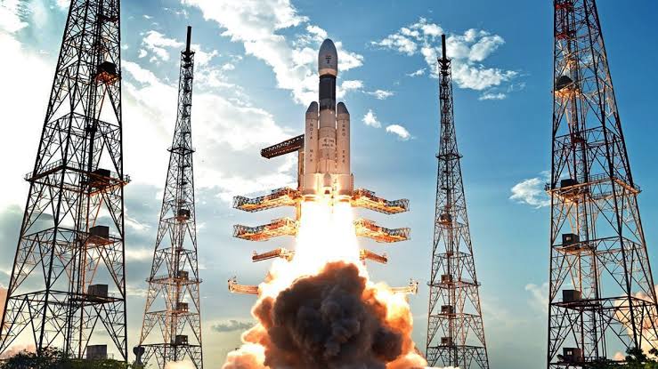
On October 30, 2026, ISRO successfully launched the NVS-03 navigation satellite aboard the GSLV-F18 rocket from the Satish Dhawan Space Centre in Sriharikota, Andhra Pradesh, at 11:51 PM IST.
NVS-03 is the third satellite in India’s second-generation navigation satellite series.
Some important features of this satellite include:
– Indigenous atomic clock: It carries an Indian-developed Rubidium atomic clock to improve the accuracy of navigation signals.
– L1 frequency: It introduces the L1 navigation signal alongside the existing L5 and S-band signals, improving compatibility with civilian navigation devices.
– Improved reliability: It is intended to strengthen NavIC and maintain continuity of navigation services.
– Strategic independence: It helps India reduce its dependence on foreign navigation technologies.
The launch is particularly significant because NavIC has faced challenges due to ageing satellites and problems with atomic clocks. NVS-03 is an important step towards restoring and strengthening the constellation.
How Does NavIC Benefit India?
NavIC has several benefits for India’s economy, security and technological development.
Strengthens National Security
NavIC provides India with an independent navigation system controlled by the Indian government.
It can support military navigation, strategic operations, and the tracking of vehicles and assets. India does not have to depend entirely on foreign navigation systems for its strategic requirements.
Reduces Dependence on GPS
GPS is operated by the United States. Other countries also operate their own satellite navigation systems.
With NavIC, India has its own navigation infrastructure. This is important because foreign systems could potentially restrict or degrade civilian services during international conflicts or emergencies.
Helps Fishermen
NavIC can help fishermen identify their locations at sea and navigate safely.
It can also support the delivery of warnings about potential fishing zones, dangerous weather and emergency situations through compatible systems.
Improves Transportation
NavIC can support navigation and tracking in:
– Railways and road transportation.
– Commercial vehicles and public transport.
– Ships and aviation-related applications.
– Emergency response and logistics services.
This can improve transportation efficiency and safety.
Supports Agriculture
Modern agriculture increasingly depends on technology.
NavIC can support precision farming, agricultural machinery, land surveying and drone-based agricultural operations. This can help farmers use resources more efficiently.
Boosts India’s Space Technology
The development of indigenous navigation satellites, atomic clocks and related technologies strengthens India’s scientific capabilities.
It also creates opportunities for Indian industries, researchers and technology companies to develop navigation-based products and services.
What Is the Future of NavIC?
India is working towards expanding and modernising its NavIC satellite constellation.
Following NVS-03, ISRO has plans for additional satellites, including NVS-04 and NVS-05, to improve the system’s reliability and continuity.
Another important development is the introduction of the L1 signal, which can make NavIC more accessible to consumer devices such as smartphones and other navigation equipment.
However, widespread adoption will also depend on manufacturers incorporating NavIC-compatible receivers into their devices.
The successful launch of NVS-03 is an important milestone in India’s journey towards technological self-reliance. NavIC is not simply an alternative to GPS; it is a strategic national asset that can strengthen India’s security, transportation, agriculture, disaster management and economic development.
By investing in its own satellite navigation infrastructure, India is moving towards greater independence in space technology.
NavIC represents an important step towards an Atmanirbhar Bharat (self dependent India), demonstrating India’s growing capabilities in science, technology and space exploration.